
Pilot Launch | Using satellite and drone data to redesign rainfed agriculture for climate resilience

Mercy Corps Ventures has launched a pilot with Artifields, a Mexico-based agtech startup using satellite and drone data to help smallholder farmers redesign their fields for better water retention and climate resilience. The pilot is one of three selected from our recent Innovative Tech for Water Security call for proposals, which received 243 applications from 48 countries.
We launched this call in response to the growing urgency of the global water crisis; 74% of climate-related disasters are connected to water, including floods, droughts, and storms. The agricultural sector accounts for nearly 70% of freshwater use across the world and 34% of the proposals we received focused on agricultural water innovations. We therefore decided to select a cohort of pilots aimed at reducing water use in agriculture while improving climate resilience. This pilot with Artifields is one of them.
Through this pilot, we are testing how nature-based crop design, powered by remote sensing and delivered via a farmer-friendly mobile app – can help smallholder farmers reduce runoff, improve soil health, and increase yields in drought-prone regions.
This post will be followed by other posts highlighting key insights after the pilot is completed. Written by Maria Gomez, Climate Venture Lab Lead at Mercy Corps Ventures and Isaac Valdivia, CEO, Artifields.
In brief:
Mercy Corps Ventures is partnering with Artifields to pilot nature-based crop design solution in Jalisco, Mexico, using satellite and drone data to help smallholder farmers capture rainwater and reduce soil erosion
This pilot emerged from our Innovative Tech for Water Security call for proposals, which received 243 applications globally and focused on reducing water use in agriculture.
The solution automates topographic mapping and delivers contour-aligned planting designs via an offline-capable mobile app, making water-smart farming accessible to smallholders without costly irrigation infrastructure/
Through this pilot, we aim to test the impact on water infiltration, soil health, and yields, while validating a scalable model for climate-resilient agriculture in rainfed systems.
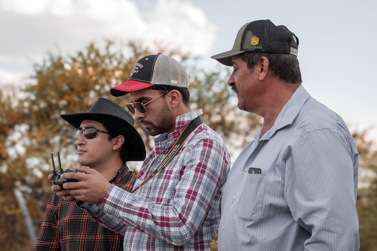
From left to right, Uriel Badillo (cofounder), Isaac Valdivia (cofounder) and Fernando Rodriguez (farmer). During a drone flight mission for topography analysis.
The Problem
Rainfed agriculture in Mexico is highly vulnerable to climate shocks
Over 70% of Mexico’s farmland is rainfed, leaving millions of smallholder farmers dependent entirely on natural rainfall to grow their crops. Nearly half of the country’s food is produced by small-scale farms, making weather patterns central to both food security and rural livelihoods. But climate change is disrupting this balance. Rainfall patterns have become increasingly erratic, with prologued droughts and sudden downpours becoming more common. Mexico has faced some of its worst droughts on record in the past decade. Most recently, in May 2025, over 75% of the country was affected by drought. These shifts are devastating for farmers, especially in regions like Jalisco, where rainfed agriculture is dominant, and climate-related crop losses are projected to be severe. Farmers are increasingly at the mercy of a climate that delivers either too little rain or too much, too fast – conditions that traditional farming systems are not designed to handle.
Poor landscape design accelerates soil erosion and water loss
The way fields are laid out plays a critical role in whether rainwater is absorbed or lost. Traditional planting methods, like straight line rows (especially if it is in mountainous regions), encourage water runoff and strip away fertile topsoil. Without contour-aligned planting, rainwater rushes off fields instead of soaking into the soil, leading to erosion, desertification, and declining productivity. Nearly 60% of Mexico’s land is affected by desertification, much of it is driven by unsustainable land use. Better landscape design, such as contour farming, can reduce annual runoff by around 10% and cut soil loss by nearly 50%. These practices help rainwater soak into the ground and replenish soil moisture – yet they remain underutilized due to access and cost barriers.
Designing water-smart fields is expensive and inaccessible for smallholders
While contour farming offers clear benefits, planning and implementing it is often out of reach for smallholder farmers. Manual methods like A-frame leveling are slow and labor-intensive, requiring hours or days to mark contour lines by hand. Professional topographic surveys, on the other hand, it requires expensive equipment and technical expertise. Most smallholders lack the time, tools, or resources to redesign their fields for better water management, leaving them vulnerable to climate stress and erosion. As a result, many farmers prioritize planting in ways that are convenient but not yet climate smart.
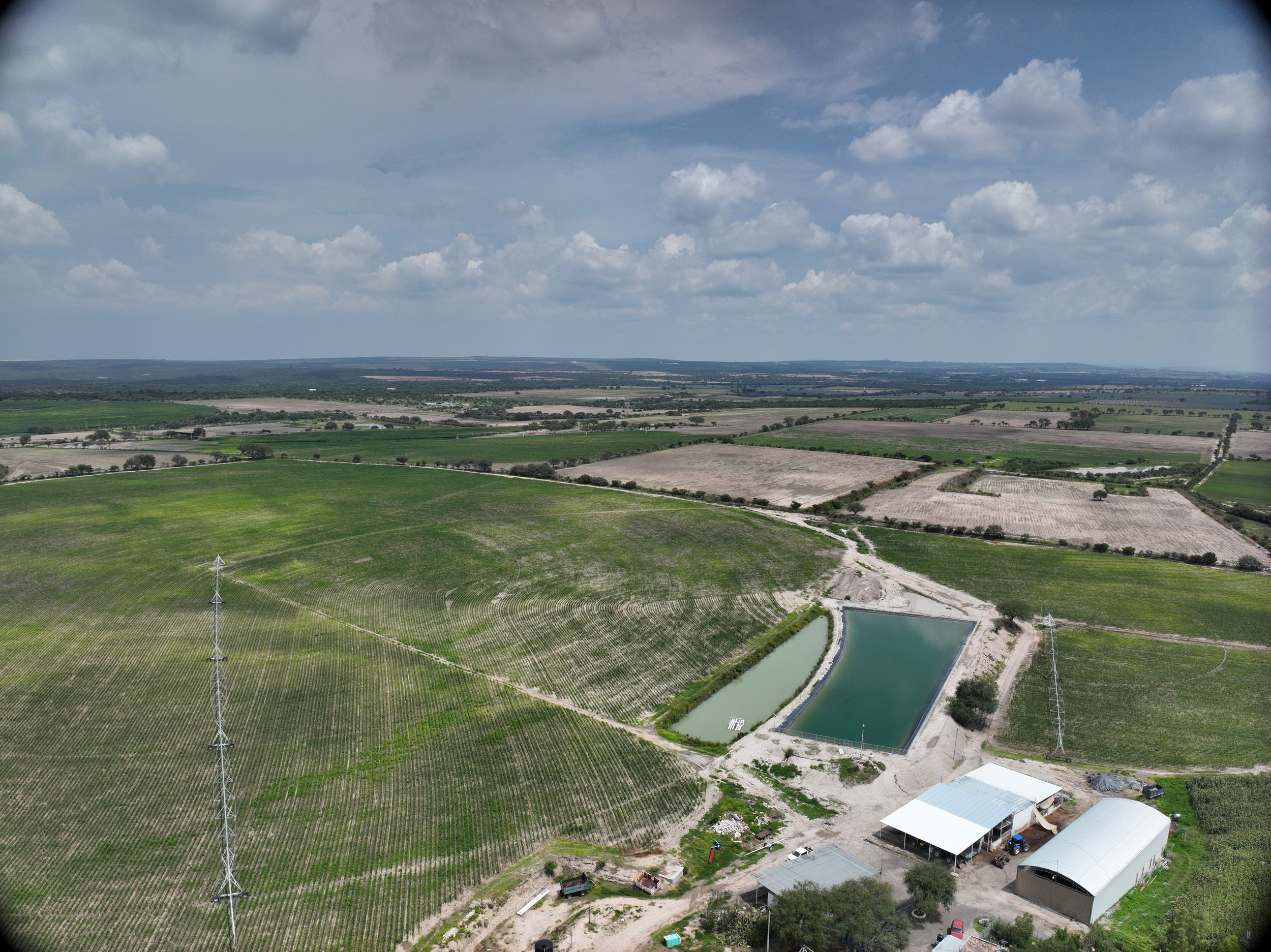
Corn fields in Mexico designed by Artifields
The Pilot
Mercy Corps Ventures is partnering with Artifields, a Mexico-based agtech startup transforming rainfed agriculture through precision topography and hydrological design. Artifields combines satellite imagery, drone data, and farmer-friendly mobile tools to help smallholder farmers redesign their fields to better capture rainfall, reduce runoff, and improve soil health. Their nature-based crop design platform generates contour-aligned planting maps that follow the land’s natural water flow, enabling farmers to implement water-smart practices without needing irrigation infrastructure or technical expertise.
Through this pilot, we are testing how Artifields’ technology can help smallholder farmers in Jalisco, Mexico, a region highly vulnerable to drought and soil degradation, improve water infiltration and crop yields. The pilot will engage 14 farmers across approximately 140 hectares, delivering tailored planting designs and training to farmers. By aligning planting rows with the terrain contours, the solution slows down water runoff, promotes infiltration, and distributes moisture more evenly across the field. This approach directly addresses the challenges of poor water retention and erosion that plague rainfed agriculture in the region.
Beyond the agronomic benefits, this pilot is also testing a new delivery model for precision agriculture. Artifields’ mobile platform is designed to be intuitive and offline-capable, making it accessible even in low-connectivity areas. By automating topographic mapping and delivering actionable insights directly to farmers, the solution removes the cost and complexity barriers that have historically kept smallholders from adopting landscape-based water management practices. If successful, this pilot could offer a scalable blueprint for improving climate resilience across Latin America’s rainfed farming systems.
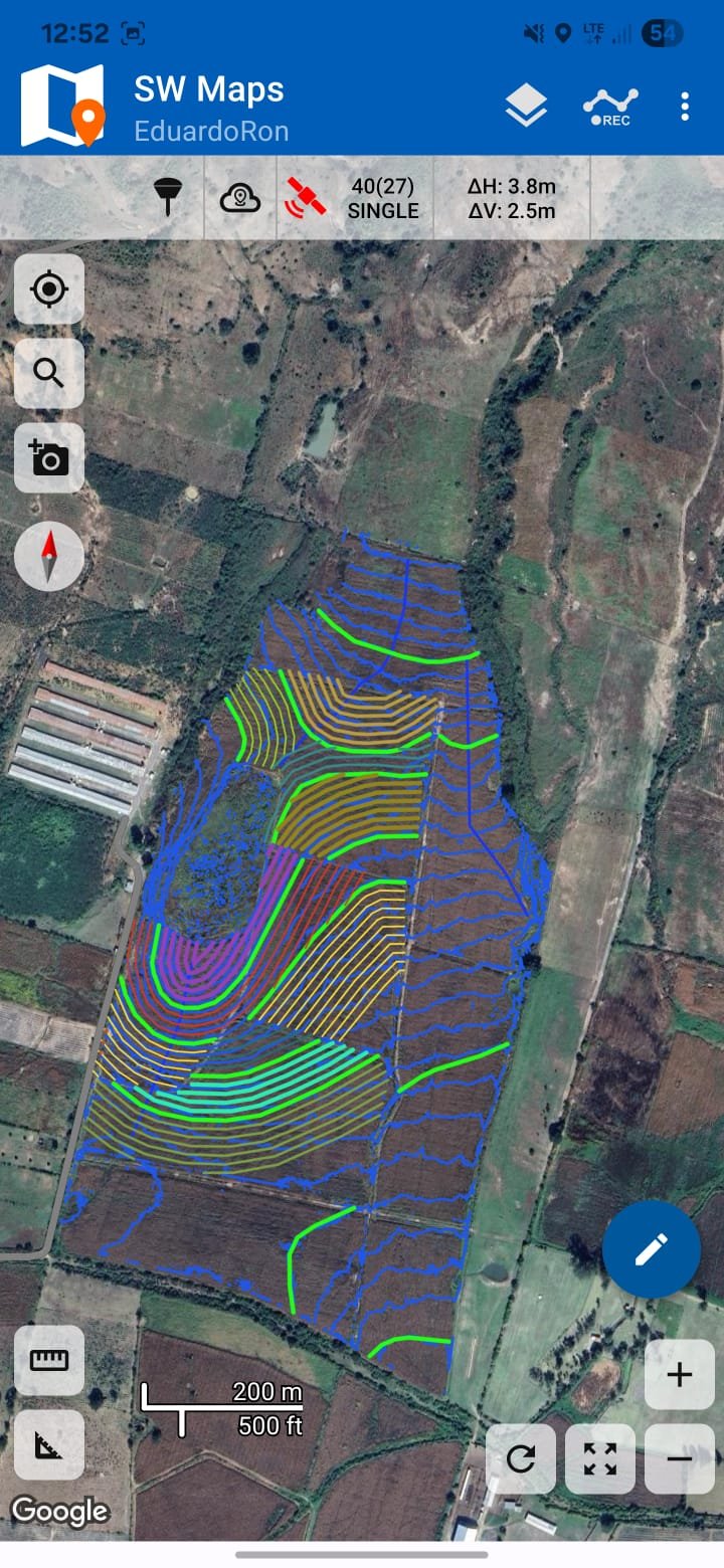
Virtual design of seeding lines for sugarcane in Mexico.
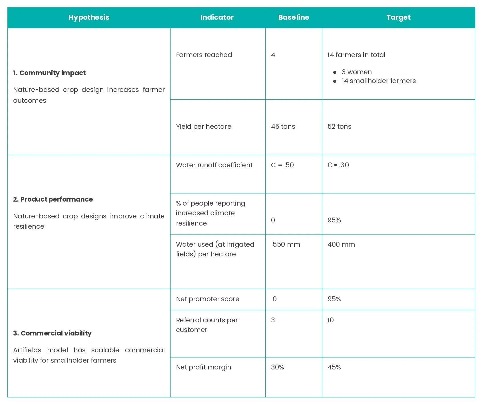
Learning Agenda & Key Hypotheses
We will test three core hypotheses during this pilot across a multiple indicators:
Stay Tuned
Stay tuned for updates, evidence, and insights on our other Mercy Corps Ventures pilots responsibly testing technology solutions to increase the climate resilience of vulnerable populations in emerging markets.